
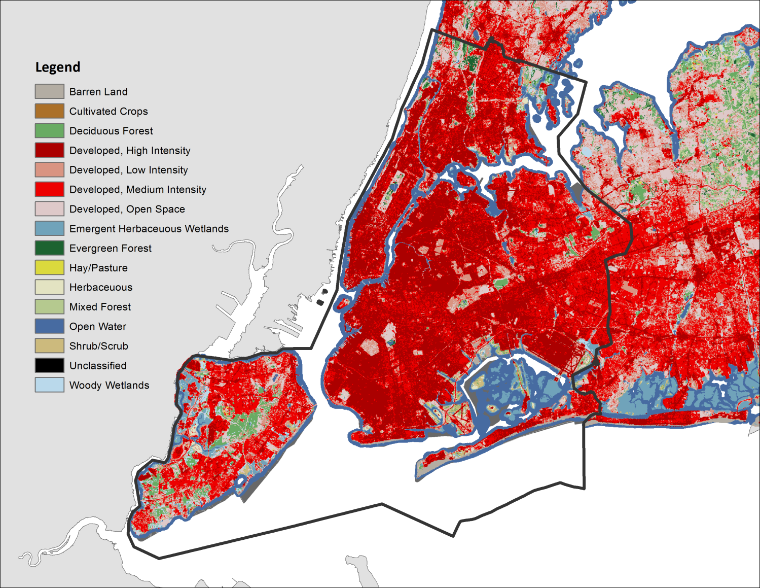
1. General Overview
Walking is not only a traveling option but a way of life. “America’s most walkable cities are also among America’s most sustainable cities, its healthiest and most prosperous communities and its happiest places.” With fewer energy consuming, less pollution, people got better access to various facilities and more open space.
Recently, “America Walks has updated its list of America’s Most Walkable Cities.” New York City’s Walk Score is an“impressive 85 out of 100, with 90% of its neighborhoods ranking highly for walkability.” This report starts from a general overview of the existing condition of walkability in New York City, and then zoom in to a small scale to further explore what elements and how they contribute to the walking environment.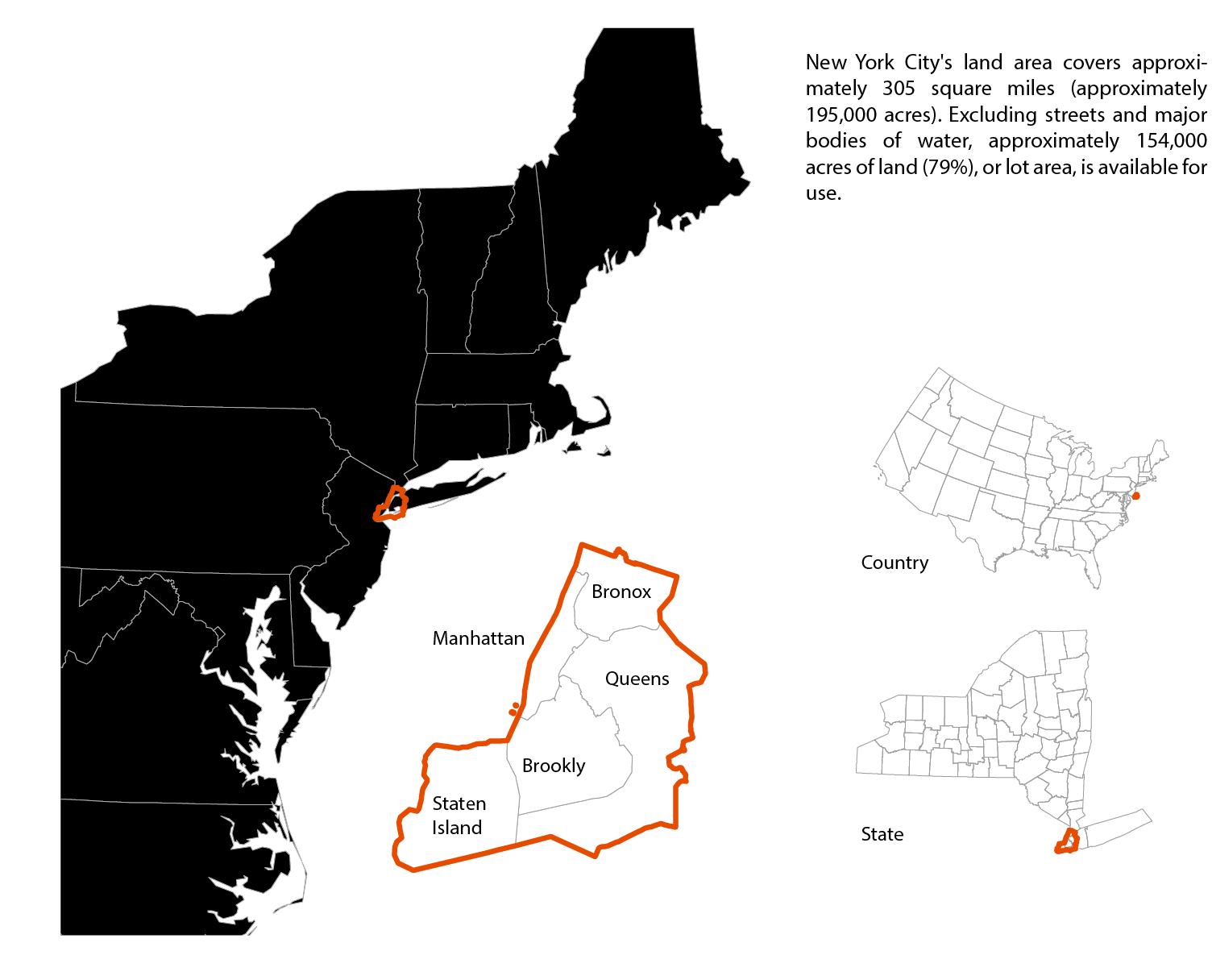
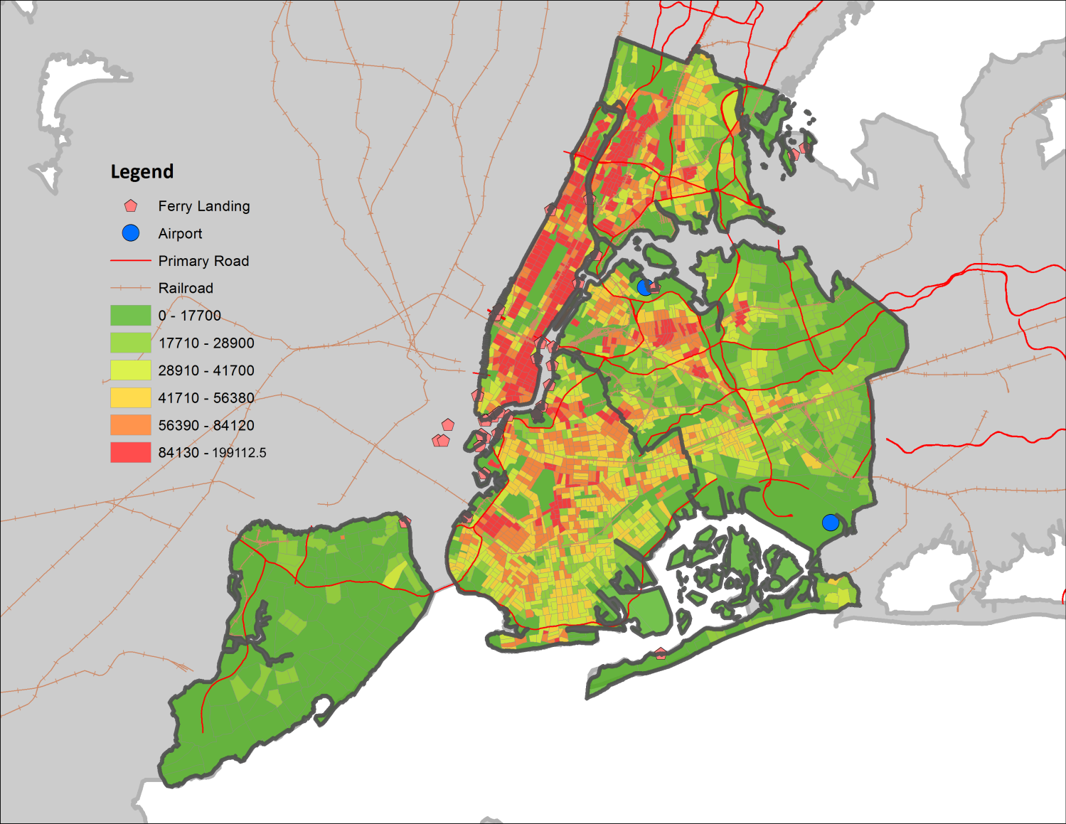
Population Density (p/mile²)


General Transportation Structure

Bike Path and Racks Serving Area

Public Transit Access
