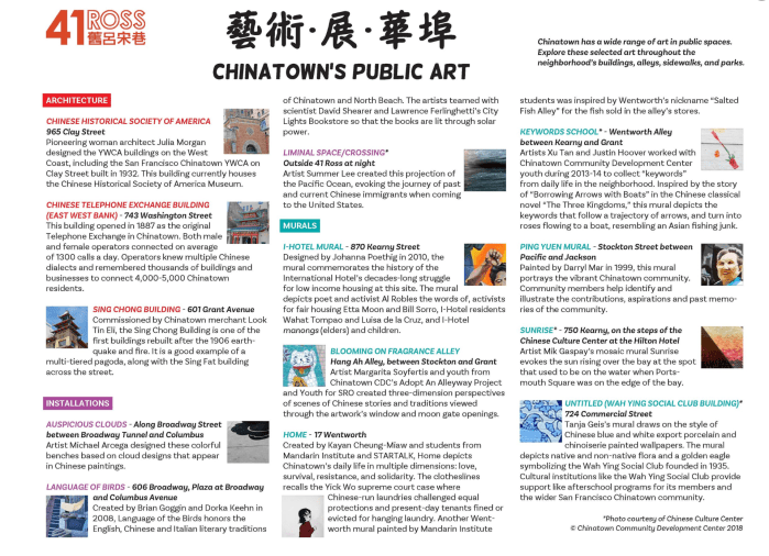
藝術展華埠: Chinatown’s Public Art
藝術展華埠: Chinatown’s Public Art was on view at 41 Ross from August 9 – 26, 2018. This exhibit featured the ways that art has defined and beautified the Chinatown neighborhood — from the colorful murals, to pagoda-styled architecture, to the everyday practices of tai chi and Cantonese opera performed on the streets and parks. The gallery also became a studio for a new mosaic mural in progress, created by the youth of Chinatown Community Development Center working with visual artist Margarita Soyfertis. Chinatown’s Public Art explored how artists and community members enhance the neighborhood through creative expressions, often incorporating community history and cultural traditions, so that people view the neighborhood in new and memorable ways.